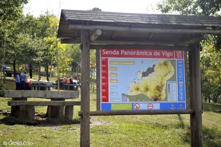
Vigo’s panoramic GR-53 trail
Contemplate the city from up high
This nature trail in Vigo circles the whole city through its mountains. The trail runs along 25 miles and is Vigo’s longest hiking trail. Given its length, it can be completed in three phases of approximately five hours each. Moreover, you’ll find numerous accesses from which to begin shorter paths.
Starting from the south, the first section is 9 miles from Saians to A Pasaxe and it has a medium-high difficulty, since it climbs upward. It begins at Saiáns Church, next to the Vigo-Baiona (PO-552) road and continues through the Municipal Hall of Ethnography, the Saiáns and Oia Forest Parks, Coruxo Parish, the petroglyphs of the Bronze Age in Fragoselo and from there, it’s a continuous climb through the Monte dos Pozos Forest Park and the mountaintops of Alba and Cepudo. After these magnificent lookouts, the trail descends to A Pasaxe, next to an industrial park between the Zamáns and Vincios parishes, in the municipality of Gondomar.
The middle section of the senda GR-53 trail, as it passes through Vigo, is 8 miles from A Pasaxe to Puxeiros and has a medium-low difficulty. It begins in A Pasaxe industrial park, where the previous section ends and continues to climb up towards Zamáns; it then runs along the reservoir, the riparian forest and the water mills. The trail continues upwards until it reaches the University of Vigo Campus, which it crosses, and then through Beade and Cabral Forest Parks, ending at the top of Puxeiros.
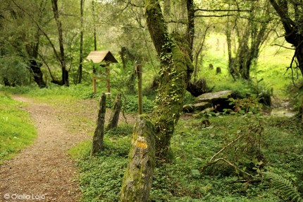
The last section of this nature trail in Vigo is almost 7 miles: Puxeiros to A Madroa. Its difficulty is medium-low and it takes approximately three and a half hours. Beginning at the top of Puxeiros, on the border with the town of Mos, it crosses Carballal and Vixiador Forest Parks. Along the way, next to the Candeán cemetery, you’ll see several prehistoric dolmens and you can stop at Vigozoo before the end of the trail in Teis Forest Park.
You can start any section of the trail from almost any of the city’s forest parks.
Practical information
Distance: 25 miles divisible in sections.
Duration time: Five hours each of the first two stages and the third is three and a half hours.
Difficulty: The first section is medium-high and the other two are medium-low.
Type of route: Not circular.